Scadbury Park
Lunch Walk
- Distance: 5.0 Km
- Elevation gain: 68 m
- Maximum elevation: 97 m
- Elevation loss: 68 m
- Minimum elevation: 48 m
- Moving time: 1 h 22 m
- Moving speed: 3.6 Km/h
- Maximum speed: 7.0 Km/h
- Total time: 1 h 54 m
- Global speed: 2.6 Km/h
Interactive trail map
Trail profile
- Distance: 5.0 Km
- Elevation gain: 68 m
- Maximum elevation: 97 m
- Elevation loss: 68 m
- Minimum elevation: 48 m
- Moving time: 1 h 22 m
- Moving speed: 3.6 Km/h
- Maximum speed: 7.0 Km/h
- Total time: 1 h 54 m
- Global speed: 2.6 Km/h
About this trail
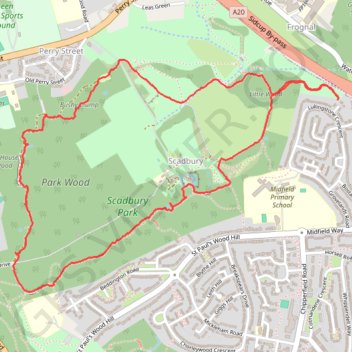
Name: Scadbury Park trail, distance, elevation, map, profile, GPS track
Coordinates: 51.40637 0.08564 51.41567 0.10655