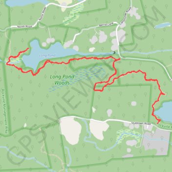
Long Pond, Ell Pond and Ashville Pond Trail in Rockville Management Area
The trail covering Long Pond, Ell Pond, and Ashville Pond is known for its rugged terrain and beautiful landscapes. This trail winds through scenic woodlands with dense mountain laurel, rhododendrons, and large glacial boulders, giving it a wild, remote feel. Though parts of the trail require careful navigation over rocky and slippery ground, the views of secluded ponds and dense forests make the effort rewarding for those seeking an immersive nature experience. #Hiking #Lake #Forest #Nature
- Distance: 7.9 Km
- Elevation gain: 92 m
- Maximum elevation: 115 m
- Elevation loss: 92 m
- Minimum elevation: 52 m
- Moving time: 2 h 46 m
- Moving speed: 2.8 Km/h
- Maximum speed: 6.6 Km/h
- Total time: 3 h 21 m
- Global speed: 2.3 Km/h
Interactive trail map
Trail profile
- Distance: 7.9 Km
- Elevation gain: 92 m
- Maximum elevation: 115 m
- Elevation loss: 92 m
- Minimum elevation: 52 m
- Moving time: 2 h 46 m
- Moving speed: 2.8 Km/h
- Maximum speed: 6.6 Km/h
- Total time: 3 h 21 m
- Global speed: 2.3 Km/h
About this trail
Name: Long Pond, Ell Pond and Ashville Pond Trail in Rockville Management Area trail, distance, elevation, map, profile, GPS track
Coordinates: 41.49994 -71.77899 41.50707 -71.75904