Make a donation
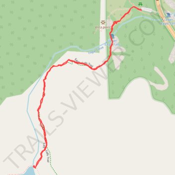
Eagle Lake Trail in Desolation Wilderness
The Eagle Lake Trail in California's Desolation Wilderness offers a moderately challenging hike through a picturesque landscape of towering pines, granite peaks, and cascading waterfalls. Starting near Emerald Bay, the trail ascends past the scenic Eagle Falls before reaching the serene Eagle Lake, nestled amidst rugged mountains. This short yet rewarding hike provides stunning views of Lake Tahoe and the surrounding wilderness, making it a must-visit for nature enthusiasts. #Hiking #Lake #Forest #Mountain #Nature
- Distance: 3.1 Km
- Elevation gain: 139 m
- Maximum elevation: 2,140 m
- Elevation loss: 138 m
- Minimum elevation: 2,007 m
- Moving time: 1 h 12 m
- Moving speed: 2.5 Km/h
- Maximum speed: 5.8 Km/h
- Total time: 1 h 47 m
- Global speed: 1.7 Km/h
Interactive trail map
Make a donation
Trail profile
- Distance: 3.1 Km
- Elevation gain: 139 m
- Maximum elevation: 2,140 m
- Elevation loss: 138 m
- Minimum elevation: 2,007 m
- Moving time: 1 h 12 m
- Moving speed: 2.5 Km/h
- Maximum speed: 5.8 Km/h
- Total time: 1 h 47 m
- Global speed: 1.7 Km/h
Make a donation
About this trail
Name: Eagle Lake Trail in Desolation Wilderness trail, distance, elevation, map, profile, GPS track
Start: Eagle Lake Trail, El Dorado County, California, United States (38.95188 -120.11324)
Coordinates: 38.94360 -120.12057 38.95207 -120.11324
Make a donation
Other hiking, mountain biking, running and outdoor activity trails
Click on a trail to view its statistics, map and profile.