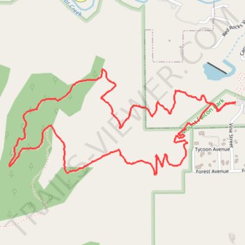
Turkey Trot Trail Loop via Castle Trail in Mount Falcon Park
From the Morrison Trailhead, the route starts on Castle Trail, leaving the edge of town for open foothill slopes, switchbacks and early views toward Red Rocks and the Denver skyline.
It then joins Turkey Trot Trail, a hiker-focused section that climbs and contours through quieter pine, scrub and rocky hillside scenery along the side of Mount Falcon.
The loop reconnects with the Castle Trail corridor for the return, descending through broader, more exposed terrain with sweeping bends, Front Range foothill views and a final approach back to the Morrison trailhead.
#Hiking #Loop #Mountain #Forest #Nature #Views
- Distance: 5.4 Km
- Elevation gain: 280 m
- Maximum elevation: 2,069 m
- Elevation loss: 280 m
- Minimum elevation: 1,833 m
- Moving time: 1 h 17 m
- Moving speed: 4.2 Km/h
- Maximum speed: 9.4 Km/h
- Total time: 1 h 21 m
- Global speed: 4.0 Km/h
Interactive trail map
Trail profile
- Distance: 5.4 Km
- Elevation gain: 280 m
- Maximum elevation: 2,069 m
- Elevation loss: 280 m
- Minimum elevation: 1,833 m
- Moving time: 1 h 17 m
- Moving speed: 4.2 Km/h
- Maximum speed: 9.4 Km/h
- Total time: 1 h 21 m
- Global speed: 4.0 Km/h
About this trail
Name: Turkey Trot Trail Loop via Castle Trail in Mount Falcon Park trail, distance, elevation, map, profile, GPS track
Start: Castle Trail, Morrison, Jefferson County, Colorado, 80465, United States (39.64686 -105.19679)
End: Castle Trail, Morrison, Jefferson County, Colorado, 80465, United States (39.64683 -105.19677)
Coordinates: 39.64291 -105.21265 39.64863 -105.19677
Other hiking, mountain biking, running and outdoor activity trails
Click on a trail to view its statistics, map and profile.
Turkey Trot Trail Loop
United States > Colorado > Jefferson County > Morrison
From the Mount Falcon Morrison Trailhead, the route sets out on Turkey Trot Trail above Vine Street, leaving the park edge for open foothill slopes, low scrub, and scattered pines with early views toward Morrison, Red Rocks Park, and the Denver plain. It continues west on Turkey Trot Trail as the loop wraps…
Distance: 5.3 Km • Elevation gain: 275 m • Maximum elevation: 2,069 m