
Bear Creek Loop Trail to Panorama Point in Corwina Park
The Bear Creek Loop Trail to Panorama Point in Corwina Park offers hikers a journey through diverse landscapes, including forested areas and sections alongside Bear Creek. The trail culminates at Panorama Point, providing expansive views of the Front Range mountains. Along the way, hikers can observe local wildlife and enjoy the natural beauty of the area. #Hiking #Mountain #Forest #Nature #Loop #River
- Distance: 10.7 Km
- Elevation gain: 440 m
- Maximum elevation: 2,241 m
- Elevation loss: 440 m
- Minimum elevation: 1,995 m
- Moving time: 2 h 51 m
- Moving speed: 3.8 Km/h
- Maximum speed: 5.7 Km/h
- Total time: 3 h 26 m
- Global speed: 3.1 Km/h
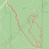
Interactive trail map
Trail profile
- Distance: 10.7 Km
- Elevation gain: 440 m
- Maximum elevation: 2,241 m
- Elevation loss: 440 m
- Minimum elevation: 1,995 m
- Moving time: 2 h 51 m
- Moving speed: 3.8 Km/h
- Maximum speed: 5.7 Km/h
- Total time: 3 h 26 m
- Global speed: 3.1 Km/h
About this trail

Name: Bear Creek Loop Trail to Panorama Point in Corwina Park trail, distance, elevation, map, profile, GPS track
Coordinates: 39.65298 -105.28135 39.66861 -105.25839
Other hiking, mountain biking, running and outdoor activity trails
Click on a trail to view its statistics, map and profile.
Panorama Point and Bear Creek Trail Loop in Corwina Park
United States > Colorado > Jefferson County
The Panorama Point and Bear Creek Trail Loop in Corwina Park offers a delightful escape into nature, combining forested stretches with sweeping views of the surrounding Rocky Mountains. As you hike, you'll pass through diverse terrain, including dense woodlands, rocky outcrops, and meadows, all while being…
Distance: 4.8 Km • Elevation gain: 197 m • Maximum elevation: 2,241 m
