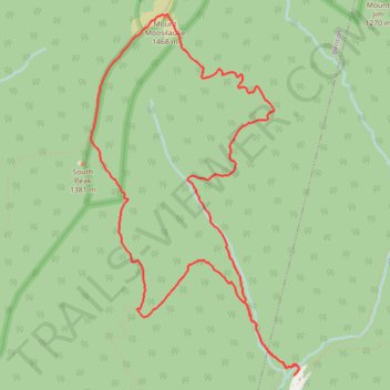
Mount Moosilauke Loop
Interactive trail map
Trail profile
- Distance: 11.7 Km
- Elevation gain: 741 m
- Maximum elevation: 1,457 m
- Elevation loss: 741 m
- Minimum elevation: 726 m
- Moving time: 4 h 41 m
- Moving speed: 2.5 Km/h
- Maximum speed: 6.7 Km/h
- Total time: 5 h 14 m
- Global speed: 2.2 Km/h
About this trail
Name: Mount Moosilauke Loop trail, distance, elevation, map, profile, GPS track
Start: Gorge Brook Trail, Woodstock, Grafton County, New Hampshire, United States (43.99360 -71.81657)
End: Gorge Brook Trail, Woodstock, Grafton County, New Hampshire, United States (43.99361 -71.81658)
Coordinates: 43.99360 -71.83995 44.02342 -71.81600
Other hiking, mountain biking, running and outdoor activity trails
Click on a trail to view its statistics, map and profile.
Mount Moosilauke Loop via South Peak in White Mountain National Forest
United States > New Hampshire > Grafton County > Woodstock
The Mount Moosilauke Loop offers a rewarding hiking experience with diverse terrains and stunning views throughout the journey. Hikers will traverse rocky paths through dense forest, with occasional views opening up to alpine landscapes as they approach the summit. At the top, panoramic vistas stretch across…
Distance: 11.9 Km • Elevation gain: 731 m • Maximum elevation: 1,458 m
Mount Moosilauke Loop in White Mountain National Forest
United States > New Hampshire > Grafton County > Woodstock
Embarking on the Mount Moosilauke Loop via the Gorge Brook Trail, Carriage Road, and South Peak offers hikers a journey through diverse terrains, from serene forested paths alongside Gorge Brook to the expansive, open summit of Mount Moosilauke. The treeless peak provides panoramic views of the surrounding…
Distance: 11.5 Km • Elevation gain: 733 m • Maximum elevation: 1,457 m