
University Yellow Trail
- Distance: 3.0 Km
- Elevation gain: 31 m
- Maximum elevation: 409 m
- Elevation loss: 29 m
- Minimum elevation: 387 m
- Moving time: 46 m 39 s
- Moving speed: 3.8 Km/h
- Maximum speed: 5.8 Km/h
- Total time: 53 m 9 s
- Global speed: 3.3 Km/h
Interactive trail map
Trail profile
- Distance: 3.0 Km
- Elevation gain: 31 m
- Maximum elevation: 409 m
- Elevation loss: 29 m
- Minimum elevation: 387 m
- Moving time: 46 m 39 s
- Moving speed: 3.8 Km/h
- Maximum speed: 5.8 Km/h
- Total time: 53 m 9 s
- Global speed: 3.3 Km/h
About this trail
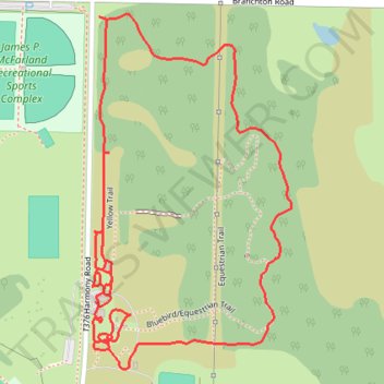
Name: University Yellow Trail trail, distance, elevation, map, profile, GPS track
Start: 1, Morrow Way, Slippery Rock, Butler County, Pennsylvania, 16057, United States (41.06534 -80.03483)
Coordinates: 41.06400 -80.03525 41.07034 -80.03053